Mapping and Way-finding - Marketing & Public Relations
3d rendition for branding planning
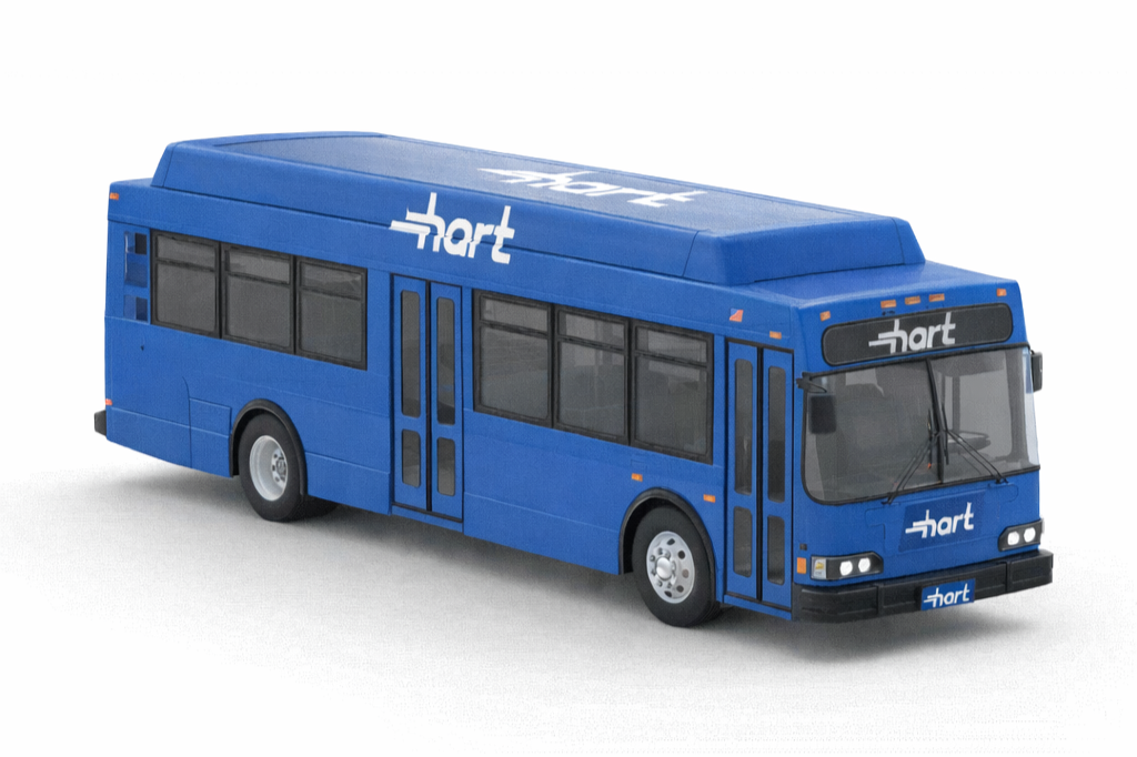
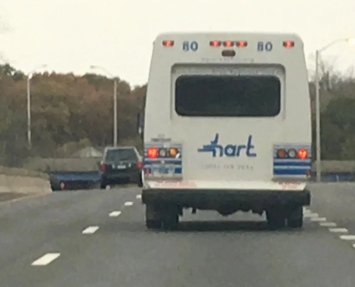
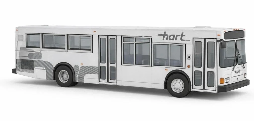
Bus fleet branding design and application specifics to bus model "Orion V".
Housatonic Area Regional Transit - Danbury, CT | 2002 - 2008
My role
Design and Way-finding Collaborate with planner to define mapping and road signage
Re-Branding (Logo, Custom font, stationary)
Marketing
Define and conduct surveys and gather results
Copy writing for advertising website content, printed material and Press Releases
Public Advocating for accessibility
Perform radio and tv interviews
Public and private business outreach and networking)
Marketing and Public Relations
Marketing and Advertising (Fundraising, Television Ads, Radio campaign coordinator).

Monthly passes depicting seasonal celebrations. Increasing collectability and increasing sales.
As a Marketing and Public Relations Coordinator for a public transit agency, I operated at the intersection of design, strategy, and user engagement. I led cross-channel marketing initiatives and public outreach efforts while representing the agency on citywide and state government boards. My work centered on increasing adoption of public transit, bicycle programs, commuter services, and paratransit accessibility through thoughtfully designed campaigns across digital, broadcast, and print media. I also conducted ridership research to inform messaging and service improvements, and managed marketing budgets to ensure alignment with strategic goals and regulatory standards.
Stationary - Logo and Branding

Redesigned printed maps that were originally larger than 11x17" and included confusing folds, to a pocketable 4"x6" double coated cardstock size. Printed in mass quantities, and increasing availability throughout the ridership area.
Design
Branding Challenge

Logo painted applied to the front of the bus as specified in the CAD images supplied
The public transit agency’s brand identity had become outdated and misaligned with its evolving services and rider expectations. While the organization had invested in a modern bus fleet and expanded commuter and paratransit offerings, its visual identity and communications failed to reflect this progress.
Key challenges included:
An overly long agency name that limited brand recognition and visibility
Low awareness of new services and technology enhancements
Inefficient communication of last-minute route changes, causing rider frustration
Slow and inconsistent production of printed outreach materials
The agency needed a refreshed brand system that improved clarity, recognition, and rider engagement while supporting faster, more effective communication.
Insights
Through stakeholder discussions, rider feedback, and internal process review, several themes emerged:
Riders associated the agency’s branding with outdated infrastructure rather than modern mobility
Clear, highly visible typography was essential for wayfinding and communications in motion
Consistency across physical and digital touchpoints was lacking, weakening trust and recall
The upcoming 50th anniversary presented a strategic opportunity to reposition the brand
These insights revealed that the rebrand needed to go beyond aesthetics — it had to function as a usability and communication system.
Solution
I led the creation of a new brand identity beginning with a redesigned logo that served as the foundation for a broader visual system.
My approach included:
Defining core brand attributes centered on mobility, accessibility, and community connection
Conducting typographic research and visual exploration focused on legibility, scalability, and motion
Iterative sketching with emphasis on curved forms and real-world application across vehicles, signage, and marketing materials
Designing a custom typeface to create a distinctive, highly visible brand presence
The final identity delivered a modern, recognizable look that translated seamlessly across buses, print collateral, and outreach campaigns, positioning the agency competitively alongside larger transit systems.
Impact
The rebrand transformed how riders perceived and interacted with the transit system by:
Increasing brand recognition and visual clarity across service areas
Improving awareness of new services and technology updates
Enabling faster, more consistent production of communication materials
Strengthening trust and engagement through a cohesive visual experience
The refreshed identity aligned the agency’s image with its modern infrastructure and growing service offerings, supporting long-term rider adoption and community engagement.


Way-finding | Mapping & Signage:
During my tenure at HART (Housatonic Area Regional Transit) I headed a collaboration between the Transportation planning team and their database of maps ArcGis and the Marketing/Design teams with a goal to keep visualizations on all platforms (web and print) accurate and reliable for riders.
Process
• Physically mapped the routes along with the teams to gather information and requirements.
• Compared the currently used print maps, against the maps built with the databases in ArcGIS, also reviewed against data from different sources of rider’s feedback to mapping and routing which included (phone call logs, bus drivers, driver’s managers, businesses along the routes.
• Put together suggestions to enhance and clarify sections of the maps to better visualize modifications in scheduling, part-time service, in order to reduce feedback,
• Export GIS software maps to a Graphically editable vector graphic version, that I could then customize to further evolve the designs to be distributed for print and web graphics using Adobe Illustrator.

Evening Bus Route map -

Bus Route map - (Route 7 Link)
Connection from Danbury to Norwalk - Connecticut.